Rev 8 Feb/2009 KMD 550/850 Quick Reference
7
OVERLAYING DATA
OVERLAY TYPE
MMOODDEE FFLLIIGGHHTT PPLLAANN SSTTOORRMMSSCCOOPPEE
®®
TTRRAAFFFFIICC MMEETTAARR DDAATTAA LLIINNKK SSCCIITT TTFFRR
LLIIGGHHTTNNIINNGG
MAP - TOPO ON Yes Yes
1
Yes
2
Yes No No Yes
5
MAP - TOPO OFF Yes Yes
1
Yes
2
Yes No No Yes
5
WX - Weather Radar Yes
1
Yes Yes
3
No No No No
WX - Stormscope
®
Yes
1
N/A No No No No No
WX - NEXRAD Yes Yes
1
Yes No Yes Yes No
WX - Precipitation Type
5
Yes No No No Yes Yes No
WX - Freezing Levels
5
Yes No No No No No No
WX - Winds Aloft
5
Yes No No No No No No
WX - Graphical METAR Yes No No N/A No No No
WX - Graphical AIRMET Yes Yes
1
No No No No No
WX - Graphical SIGMET Yes Yes
1
No No No No No
WX - Graphical Convective Yes Yes
1
No No No No No
SIGMET
WX - Graphical Wx Watches Yes
4
Yes
1, 4
No No No No No
TERR Yes Yes
1
Yes
2
No No No No
TRFC Yes
1
No N/A No No No No
1 Requires remote heading input 3 TIS requires remote heading input 5 Not available with VHF
2 TCAS/TAS requires remote heading input 4 Not available with XM Datalink FIS
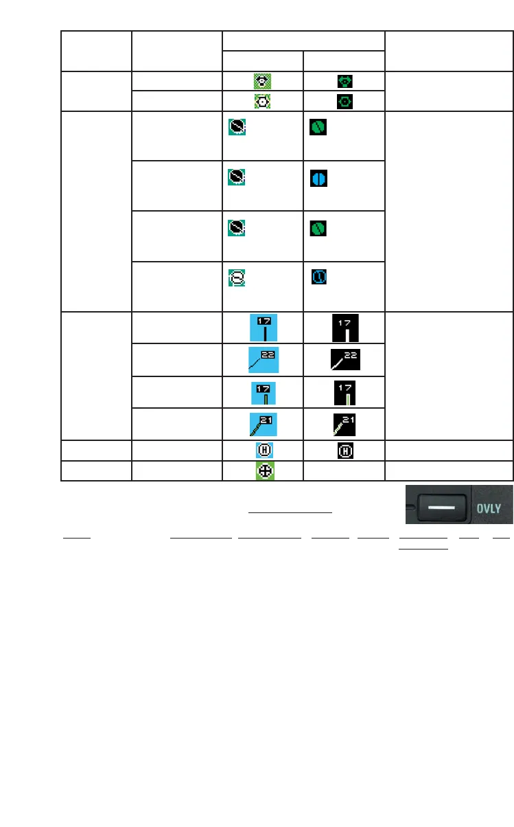
Feature Conditions Map Icons Other Characteristics
TOPO on TOPO off
VORs With DME
Without DME
Airports Hard runway +
IFR approach
Line rep-
resents
primary runway
Line rep-
resents
primary runway
If the database does not
have runways for the air-
port, then the icon will not
indicate a runway (no line
will be displayed).
Hard runway, no
IFR approach
Line rep-
resents
primary runway
Line rep-
resents
primary runway
IFR approach
available
Line rep-
resents
primary runway
Line rep-
resents
primary runway
Soft or unknown
runways
Line rep-
resents
primary runway
Line rep-
resents
primary runway
Airport
Runways
Primary, hard
surface
Runways are shown for
airports within 5 nm of
current position and
selected range is 10 nm
or less. Runway ends are
labeled with the proper
runway identifier if
selected range is 1 nm.
Other hard sur-
face
Primary soft sur-
face
Other soft sur-
face
Helipads
VRPs Not displayed